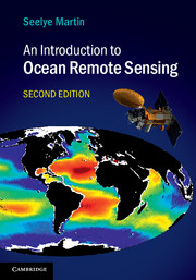
An Introduction to Ocean Remote Sensing
Fully updated, with significant new coverage of advances in satellite oceanography and results from new satellite missions, the second edition of this popular textbook introduces students to how remote sensing works, how to understand observations from Earth-observing systems, and the observations' importance to physical and biological oceanography. It provides full explanations of radiative transfer, ocean surface properties, satellite orbits, instruments and methods, visible remote sensing of biogeochemical properties, infrared and microwave retrieval of sea surface temperature, sea surface salinity retrieval, passive microwave measurements, scatterometer wind retrieval, altimetry and SAR. Also included are descriptions of the online archives where data can be obtained, and readers can obtain online tools for working with the data - enabling hands-on engagement with real-world observations. This is an ideal textbook for graduate and advanced undergraduate students in oceanography, remote sensing and environmental science, and a practical resource for researchers and professionals working with oceanographic satellite data.
- Provides the necessary background in the physical and biological aspects of the ocean and atmosphere, enabling students to understand measurements from Earth-observing systems and the resultant data
- Describes multi-national remote sensing, where constellations of complementary satellites focus on a single variable such as sea surface height, giving students an appreciation of societal needs contributing to better research
- Includes examples of online archives where data can be obtained and provides links to sites where readers can obtain online tools for working with the data, enabling hands-on engagement with real-world observations
Reviews & endorsements
'This complex book has been written by a practitioner who is aware of the requirements of the user, but he presents the required information in a concise and yet accessible form.' Averil Leaver, Open University Geological Society Journal
Product details
April 2014Adobe eBook Reader
9781139898522
0 pages
0kg
235 b/w illus. 24 colour illus. 38 tables
This ISBN is for an eBook version which is distributed on our behalf by a third party.
Table of Contents
- Preface
- List of chemical symbols
- List of mathematical symbols
- List of abbreviations and acronyms
- 1. Background
- 2. Ocean surface phenomena
- 3. Electromagnetic radiation
- 4. Atmospheric properties and radiative transfer
- 5. Reflection, transmission and absorption at the atmosphere/ocean interface
- 6. Ocean color
- 7. Infrared observations of sea surface temperature (SST)
- 8. Introduction to microwave imagers
- 9. Passive microwave observations of the atmosphere and ocean surface
- 10. Introduction to radars
- 11. Scatterometers
- 12. The altimeter
- 13. Imaging radars
- 14. Other missions: the gravity missions, ICESat-1 and -2, CryoSat-2, SMOS, Aquarius/SAC-D
- Appendix: useful data tables
- References
- Index.


