
Historical GIS
Historical GIS
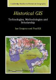
Historical GIS is an emerging field that uses Geographical Information Systems (GIS) to research the geographies of the past. Ian Gregory and Paul Ell's study, first published in 2007, comprehensively defines this field, exploring all aspects of using GIS in historical research. A GIS is a form of database in which every item of data is linked to a spatial location. This technology offers unparalleled opportunities to add insight and rejuvenate historical research through the ability to identify and use the geographical characteristics of data. Historical GIS introduces the basic concepts and tools underpinning GIS technology, describing and critically assessing the visualisation, analytical and e-science methodologies that it enables and examining key scholarship where GIS has been used to enhance research debates. The result is a clear agenda charting how GIS will develop as one of the most important approaches to scholarship in historical geography.
Product details
December 2007Hardback
9780521855631
240 pages
253 × 180 × 12 mm
0.63kg
8 colour illus. 3 tables
Available

Table of Contents
- List of figures
- List of tables
- 1. GIS and its role in historical research: an introduction
- 2. GIS: a framework for representing the Earth's surface
- 3. Building historical GIS databases
- 4. Basic approaches to handling data in a historical GIS
- 5. Using GIS to visualise historical data
- 6. Time in historical GIS databases
- 7. Geographic information retrieval: historical geographic information on the internet and in digital libraries
- 8. GIS and quantitative spatial analysis
- 9. From techniques to knowledge: historical GIS in practice
- References.