
Historic Maps of Bahrain 1817–1970 3 Volumes Hardback Set
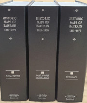
Historic Maps of Bahrain 1817–1970 3 Volumes Hardback Set
£1,050.00
GBPIn celebration of the 25 years of Bahrain independence in 1971, Archive Editions presents an impressive collection of previously scattered historic maps and charts of Bahrain island and the surrounding territories. This collection comprises 69 surveys, charts and plans of Bahrain, many in colour, including the complete island and surrounding waters and islands. The publication makes valuable maps available which were previously unknown or inaccessible and is particularly important because of its diversity of sources including some private collections. It begins in 1817 with the first ever mention of Muharraq City on a map and finishes in 1970 with the last maps made before independence. It includes the first ever town plans of Manama and Muharraq to be compiled by the Government of Bahrain, and the first ever accurate land survey of the Hawar islands. There is also a detailed commentary on each map in a separate booklet.
- A unique diversity of sources. This collection has been gathered together from the following: Ministry of Housing, Municipalities and Environment, Bahrain; Hydrographic Office, Taunton, UK; Ministry of Defence, Military Surveys, Directorate of Geographic Information, Tolworth, UK; British Library: Map room and Oriental and India Office collections, London, UK.
- The editor has compiled a comprehensive list of all the British surveyed maps of Bahrain, from the earliest survey of Bahrain and Arad islands in 1817 to the last maps just prior to Independence in 1971. Each 'first time' map represents a new perception of Bahrain: in the early days, in terms of geographic accuracy; in recent years, in terms of features depicted and of the maps as a record of civic development.
Product details
August 2020Multiple copy pack
9781788060790
56 pages
275 × 202 × 230 mm
3.36kg
Available


Table of Contents
- Naval Surveys 1817–1937
- Land Surveys of Bahrain 1904–1969
- Town Maps: Manama City and Suburbs 1926–1956
- Manama City and Suburbs 1957–1970
- Muharraq Town and Island 1931–1970
- Awali 1957–1963.